Susak
Susak Sailing Guide: A Soft-Sand Island at the Edge of the Northern Adriatic
Out in the northern Adriatic, slightly detached from the main Kvarner island network, lies Susak - a small, low-lying island that feels fundamentally different from almost every other sailing destination in Croatia. While much of the Adriatic is defined by rugged limestone formations, steep coastal contours, dense pine vegetation, and sharply indented bays, Susak stands apart through its unusual geology, soft sandy terrain, and gently sculpted shoreline.
For sailors approaching from Mali Lošinj or the wider Lošinj archipelago, Susak often appears almost understated at first glance - an elongated, pale outline resting low on the horizon. There are no dominant peaks, no rocky cliffs rising above the sea, and no dramatic vertical coastline. Instead, the island presents a horizontal and visually minimal profile that contrasts sharply with the surrounding Kvarner islands.
This simplicity in appearance is deceptive. Beneath its modest silhouette, Susak offers one of the most unusual and geologically distinct coastal environments in the entire Adriatic sailing system. Its character is not defined by height or structure, but by texture - soft sand, gentle slopes, and coastline shaped continuously by wind and sea over time.
Unlike heavily structured marina destinations or extended coastal towns, Susak is defined by its isolation and minimal development. There is no continuous waterfront promenade, no dense harbour infrastructure, and no expanded urban shoreline. The built environment remains concentrated and small in scale, leaving much of the island’s coastline open and uninterrupted.
This creates a sailing experience that feels spatially different from more developed Adriatic stops. Instead of approaching a town that gradually expands along the coast, sailors encounter an island where land, sea, and sand merge into a single continuous landscape. The transition from water to shore is often subtle rather than abrupt, with shallow gradients and soft visual boundaries shaping the coastline.
From a maritime perspective, this lack of structural density enhances the sense of openness. Anchorages and coastal stops feel less defined by infrastructure and more by natural form. The island does not guide sailors through architectural markers or harbour systems in the same way larger destinations do; instead, it presents a quieter, more elemental interaction between vessel and environment.
The absence of heavy development also reinforces Susak’s distinctive atmosphere within the wider Kvarner region. While nearby islands such as Lošinj are characterised by forested slopes, active marinas, and layered maritime activity, Susak remains minimal, low, and visually continuous with the sea itself. This contrast is particularly noticeable when moving between islands within the same sailing itinerary.
For crews navigating the northern Adriatic, Susak therefore functions less as a conventional harbour destination and more as a change in environmental rhythm. It introduces a softer visual language into the sailing journey - one defined by sand rather than stone, horizontality rather than elevation, and openness rather than enclosure.
Even from offshore, this difference is immediately perceptible. Where other islands present rugged outlines or green, elevated profiles, Susak appears almost flattened against the sea. This creates a distinctive navigational impression, especially in clear weather when the pale tones of the island contrast strongly with the deeper blues of the surrounding Adriatic.
Ultimately, Susak stands as one of the most unusual sailing environments in Croatia precisely because it resists the typical visual and geological patterns of the region. It is not defined by dramatic arrival, dense harbour life, or complex coastline structure, but by simplicity, softness, and spatial calm.
Within the broader northern Adriatic sailing system, Susak offers something rare: an island where the usual hierarchy of cliffs, marinas, and urban waterfronts disappears, leaving instead a minimal, sand-shaped landscape where sea and land meet in the quietest possible form.
A Unique Island Formed by Sand and Wind
The defining feature of Susak is its geology, which sets it apart not only within the northern Adriatic but across the entire Croatian coastline. While most Adriatic islands are composed primarily of limestone - creating rugged cliffs, sharp coastal edges, and deeply indented rocky bays - Susak is formed largely from layers of sand and fine sediment. This rare geological foundation gives the island an entirely different coastal identity, both visually and structurally.
Over centuries, wind and sea have continuously reshaped this sandy composition. Unlike harder rock formations that create abrupt shorelines and steep drop-offs, Susak’s softer material allows for gradual transformation. The coastline has been smoothed into flowing curves, shallow inlets, and gently sloping beaches that extend naturally into the sea. The result is a shoreline that feels unusually soft and continuous, as if the island has been gently sculpted rather than carved.
This constant interaction between wind and sediment is essential to understanding the island’s character. The landscape is not static in the way rocky islands tend to be; instead, it carries a subtle sense of movement and refinement over time. Even the smallest coastal details - sand ridges, shallow gradients, and beach contours - reflect the long-term influence of natural forces acting on a fragile geological base.
From a sailing perspective, this creates an immediate and striking visual contrast. After navigating the more rugged islands of the Kvarner region, where stone coastlines dominate and vegetation often clings to elevated terrain, approaching Susak feels like entering a completely different coastal environment. The island appears lighter in tone, softer in outline, and more horizontally open than its neighbours.
Where surrounding islands present vertical profiles and textured rocky shorelines, Susak introduces a calm, low-contrast silhouette that sits gently on the horizon. This difference becomes even more pronounced in changing light conditions, particularly during early morning or late afternoon, when the pale sandy tones of the island reflect softly against the surrounding sea.
The seabed around Susak is equally influenced by this sandy geological composition. In shallow areas, especially near the coastline and sheltered bays, the bottom is often composed of fine sand that enhances water clarity and light reflection. During calm weather conditions, this produces distinctive pale turquoise and light blue tones that differ noticeably from the deeper, darker waters typical of rocky anchorage zones elsewhere in the Adriatic.
These visual characteristics contribute to one of the island’s most memorable qualities: its sense of softness. Everything - from shoreline gradients to underwater visibility - feels more gradual and less abrupt than in traditional limestone environments. For sailors, this changes not only the appearance of the island but also the perception of space and depth when approaching anchorages or navigating nearby waters.
For crews accustomed to rocky anchorages with steep seabed drops and rugged coastal contours, Susak often feels like a natural shift in environment rather than a conventional stop along a route. It introduces a different spatial rhythm to sailing - one where transitions between sea and land are slower, more continuous, and visually less defined.
This shift is subtle but meaningful. After days spent navigating islands with strong relief and dramatic coastlines, the soft geometry of Susak offers a contrasting experience that recalibrates the visual language of sailing in the region. The horizon feels lower, the shoreline more fluid, and the overall environment more open and relaxed.
In this way, Susak does not rely on dramatic navigation challenges or complex harbour structures to leave an impression. Instead, its impact comes from contrast - its ability to transform the surrounding sailing experience simply by existing as a geological exception within a predominantly rocky Adriatic world.
Approaching Susak: Open Adriatic and Soft Horizons
Sailing approaches to Susak are typically made from the wider Kvarnerić area or from nearby islands such as Ilovik and Lošinj. This part of the northern Adriatic is notably more open than sheltered mainland coastal corridors, with longer visual distances between landmasses and a stronger, more continuous sense of sea exposure. Instead of navigating close-to-shore routes where land is constantly present on one side, sailors often find themselves moving across broader stretches of water where the horizon becomes the dominant reference point.
This openness fundamentally shapes the approach experience. The Adriatic here feels less contained and more expansive, with island silhouettes appearing gradually rather than emerging suddenly from behind coastal formations. Navigation becomes a process of reading distance and horizon alignment rather than following tightly defined coastal contours. For many crews, this shift marks a subtle transition into a more open-sea style of cruising while still remaining within the protected framework of the Croatian island system.
As Susak comes into view, its low profile is immediately distinctive. Unlike surrounding islands that often rise into visible ridgelines or forested elevations, Susak presents a thin, elongated shape that sits close to the waterline. There are no steep hills, no dominant peaks, and no layered coastal silhouettes. Instead, the island appears as a soft horizontal form gently emerging from the sea surface.
This simplicity makes navigation visually straightforward. In clear conditions, the island is easy to identify early on the approach, particularly due to its pale tones and low elevation. The contrast between the light sandy hues of Susak and the deeper blues of the surrounding Adriatic water becomes increasingly pronounced as distance closes, creating a clean and legible visual separation between sea and land.
At the same time, this minimal profile gives the approach a distinctly atmospheric quality. Because there are no high points or vertical landmarks, the island does not impose itself dramatically on the horizon. Instead, it appears gradually and almost quietly, reinforcing the sense that sailors are entering a different type of coastal environment - one defined by softness and subtlety rather than elevation and structure.
In good visibility, this effect is particularly striking. The pale coloration of Susak stands out clearly against the deeper blue of open water, while the surrounding Kvarnerić seascape remains broadly unobstructed. The absence of dense coastal development or tall natural formations ensures that the island remains visually isolated even at medium distances, enhancing its sense of separation from the wider archipelago.
The approach itself is generally straightforward under stable summer conditions, especially when weather systems are calm and wind patterns remain predictable. The island does not require complex channel navigation or tightly controlled harbour entry procedures, which contributes to its accessibility for a wide range of sailing experience levels.
However, the openness of the surrounding sea introduces an important dynamic element. Because there are fewer landforms to interrupt wind flow, conditions around Susak can feel more directly influenced by regional weather patterns. Wind strength and wave development may be more noticeable here than in sheltered island channels or enclosed bays, particularly during periods of increased Maestral activity or changing pressure systems.
This creates a distinctive balance between exposure and simplicity. The navigation itself remains visually uncomplicated, yet the environmental conditions can be more expressive than in protected waters. Sailors often experience a gradual shift from calmer inter-island passages into more open-sea sailing behaviour as they approach Susak, even if the distances involved remain relatively short.
This interplay between clarity and exposure is a defining characteristic of sailing in this part of the Adriatic. The approach does not overwhelm with navigational complexity, but it does remind crews of the broader maritime context in which they are sailing - an open island sea where weather, distance, and horizon all play active roles.
Ultimately, arriving at Susak is less about technical challenge and more about spatial transition. The journey highlights a shift in scale: from the structured, multi-island geography of Kvarner toward a softer, more open horizon where land becomes minimal and sea becomes dominant.
Harbour and Anchorage Experience
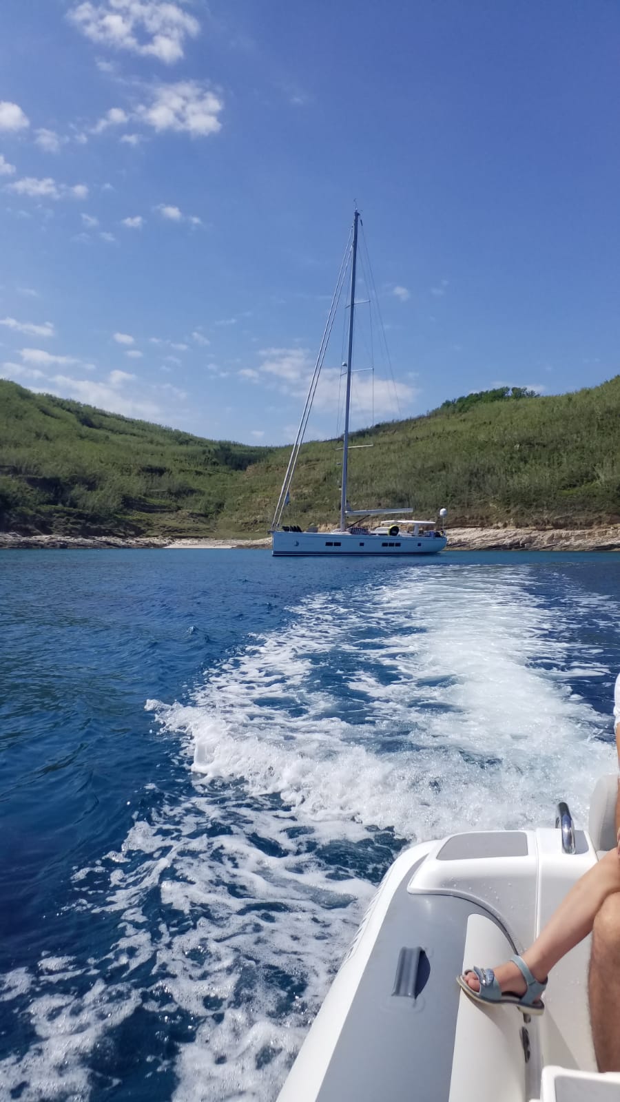
The main settlement on Susak is small, compact, and closely tied to the island’s natural coastline. The harbour is modest in scale and primarily serves local vessels alongside occasional visiting yachts, maintaining a simple and functional maritime structure rather than a developed nautical hub. Unlike larger Adriatic towns where marinas expand into multi-pier complexes with extensive services and layered berthing systems, Susak offers a far more restrained and direct harbour experience.
There is no sense of infrastructural density or navigational complexity on arrival. Instead, the harbour integrates naturally into the shoreline, following the island’s gentle contours and sandy geography. Mooring and anchoring are straightforward in character, with arrangements that reflect the island’s limited scale and its emphasis on low-impact maritime activity. For sailors, this creates an experience that feels intuitive rather than procedural - more about reading the water and coastline than navigating structured marina layouts.
Anchorages around Susak are typically found within sheltered sections of the bay, where the island’s natural curvature and low elevation provide protection from prevailing conditions. These areas are especially suited to calmer summer weather, when wind and wave activity remain moderate and anchoring becomes a relaxed extension of the sailing day rather than a technical operation.
A defining characteristic of these anchorages is the seabed composition. The sandy nature of the island extends beneath the water, creating holding conditions that are generally reliable in stable weather. Unlike rocky anchorages where depth can change abruptly or anchoring requires precise positioning between stone formations, Susak’s seabed tends to transition more gradually. Depth increases smoothly away from shore, mirroring the island’s soft and continuous topography above water.
This gradual underwater landscape contributes to the overall feeling of simplicity that defines the anchoring experience here. Boats settle into position without the visual or structural complexity often associated with more rugged Adriatic environments. The combination of sand, shallow gradients, and sheltered conditions reinforces the island’s broader identity as a place shaped by softness rather than sharp geological contrast.
What stands out most, however, is the absence of commercial maritime density. There is no large-scale charter turnover, no busy ferry interchange hub, and no continuous flow of high-traffic maritime routes intersecting the harbour area. The movement of vessels is limited and naturally paced, allowing the anchorage environment to remain calm even during the peak summer season.
This lack of maritime congestion has a direct impact on the overall atmosphere. The soundscape around Susak is defined primarily by natural elements - wind moving across open water, the gentle motion of anchored boats, and the soft interaction of sea against sandy shoreline. Mechanical and urban maritime noise is minimal, reinforcing the sense of separation from busier Adriatic destinations.
Occasional movement of small local boats provides the only regular activity within the harbour area, maintaining a quiet but continuous connection between the settlement and its surrounding waters. These movements are typically simple and functional rather than commercial or touristic in scale, further supporting the island’s understated maritime character.
In this way, the harbour and anchorage experience at Susak is defined not by infrastructure, but by absence - absence of congestion, absence of complexity, and absence of large-scale maritime systems. What remains is a direct and unfiltered interaction with the natural environment, where sailing, anchoring, and island life exist in their most minimal and unstructured form.
Sailing Conditions Around Susak
The sailing environment around Susak is shaped primarily by its position within the wider Kvarnerić region, one of the more open and meteorologically active parts of the northern Adriatic. Unlike the more sheltered western coastline of Istria, where landforms and dense island chains help moderate wind behaviour, this area is characterised by broader sea exposure and fewer physical barriers. As a result, wind patterns and surface conditions can shift more noticeably over relatively short distances, creating a sailing environment that feels both dynamic and open.
During the summer season, the Maestral is the most consistent and reliable wind influence. Typically developing in the afternoon from the northwest, it provides a steady breeze that supports comfortable inter-island navigation between Lošinj, Ilovik, and the surrounding Kvarner waters. Around Susak, this wind often feels more direct and unobstructed than in more sheltered regions. Because the island has a very low profile and lacks tall vegetation or elevated terrain, there is little to disrupt or deflect airflow. The result is a cleaner wind profile, where gusts arrive with greater consistency and less turbulence caused by land interaction.
For sailors, this creates a distinctive sensation underway. Sailing near Susak often feels more “pure” in terms of wind engagement - sails respond directly to atmospheric conditions with fewer local distortions. Course adjustments tend to be more predictable, but also more sensitive to regional wind strength, particularly when moving between exposed channels and slightly more protected island corridors.
The Bura wind introduces a different dimension to sailing conditions in this region. When active, it can produce stronger northeasterly gusts that accelerate across open water, especially through the natural corridors formed between islands. In the Kvarnerić, this can lead to sharper sea states compared to more enclosed sailing areas further south or along the Istrian coast. Around Susak, the lack of significant elevation means there is minimal shielding, allowing wind energy to reach the sea surface with greater intensity.
Despite this, the surrounding island geography plays an important balancing role. Nearby islands such as Lošinj and Ilovik provide alternative sheltered passages and anchoring options when conditions become more demanding. This network of islands creates a natural flexibility in route planning, allowing sailors to adapt quickly between exposed and protected waters depending on weather developments.
This interplay between exposure and shelter is a defining feature of sailing around Susak. The island does not exist within a uniformly calm or uniformly challenging environment. Instead, it sits within a transitional maritime zone where conditions can shift between relaxed summer cruising and more energetic wind-driven sailing within the same day.
Because of this variability, navigation in the area is often less about fixed routes and more about continuous interpretation of wind, sea state, and island positioning. Crews moving through Kvarnerić frequently adjust plans based on how conditions evolve across open water versus protected channels, making situational awareness more important than strict itinerary structure.
At the same time, this variability is part of what makes the region appealing. The sailing experience is not uniform or predictable in a static sense, but layered and responsive. Light afternoon breezes, stronger regional winds, and the shifting shelter provided by nearby islands all combine to create a sailing environment that feels alive and constantly in motion.
In this context, Susak functions as both a reference point and a weather-sensitive waypoint within the broader Kvarner system. It sits at the intersection of open-sea influence and island protection, offering sailors a clear example of how geography and wind interact to shape navigation in the northern Adriatic.
Swimming in Soft Sand Waters
Swimming around Susak is one of the most distinctive water experiences in the northern Adriatic, largely because of the island’s unusual sandy geology and extremely gentle coastal gradients. Unlike much of the Croatian coastline - where rocky seabeds, steep drop-offs, and sharply defined shorelines are the norm - Susak offers a far softer and more gradual transition between land and sea.
The sandy seabed plays a central role in shaping the underwater visual character. In shallow areas, particularly close to the shoreline and within sheltered bays, the water often takes on exceptionally light tones. Under stable summer weather and clear sunlight, these shallow zones can appear almost luminous, shifting between pale turquoise, soft aquamarine, and transparent blue depending on depth and angle of light. This visual clarity is a direct result of fine sediment and sand reflecting sunlight more evenly than rocky or seagrass-dominated seabeds.
One of the most notable aspects of swimming here is the gradual nature of depth change. Instead of quickly stepping into deep water as is common along rocky coves in the Adriatic, swimmers around Susak often experience long, shallow entry zones extending well offshore. This creates a fluid, almost continuous gradient from beach to open water, reinforcing the island’s overall sense of softness and horizontal simplicity.
Compared to more typical Adriatic islands, where swimming is often defined by cliffs, stone platforms, or narrow rock entry points, Susak offers a completely different interaction with the sea. There are no jagged coastal edges or elevated jump points shaping the experience. Instead, the shoreline feels open, accessible, and naturally inviting, with the sea meeting land in a slow and uninterrupted transition.
This lack of dense coastal development further strengthens the experience. Large beachfront infrastructure, structured bathing zones, or heavy waterfront construction are absent from much of the island. As a result, swimming areas feel more organic and less defined by human organisation. The environment remains visually simple, allowing the natural relationship between sand, sea, and light to dominate the experience.
For sailors, swimming around Susak often becomes an integrated part of anchoring rather than a separate activity requiring planning or designated stops. When a vessel settles in calm conditions near the shoreline, the surrounding environment naturally encourages time in the water. The transition from sailing to swimming is immediate and seamless, shaped more by weather and mood than by infrastructure or formal beach access points.
Anchored boats sit in relatively calm, shallow waters where movement is gentle and predictable in stable summer conditions. From deck level, the proximity of sandy seabed and clear water creates a strong visual connection between vessel and environment, often prompting spontaneous swimming stops without the need for specific facilities or organised access.
This simplicity is one of the defining qualities of swimming in this part of the Adriatic. There are no structured beach clubs, no dense resort zones, and no layered coastal development shaping how the sea is used. Instead, swimming exists as a direct extension of the sailing environment itself - natural, unmediated, and closely tied to the island’s physical form.
Ultimately, the experience around Susak is not defined by activity or infrastructure, but by clarity and calmness. The combination of sandy seabeds, shallow gradients, and open coastal space creates a swimming environment that feels unusually pure within the Adriatic context - simple in structure, but rich in sensory detail.
Island Atmosphere and Everyday Rhythm
Life on Susak follows a noticeably slower and more isolated rhythm than most other destinations in the Adriatic. The island’s small settlement is concentrated and compact, and its connection to the wider region depends almost entirely on sea access. This physical separation naturally shapes daily life, reinforcing a sense of distance from larger island centres such as Mali Lošinj, where maritime traffic, services, and population flow are significantly more active and continuous.
Because of this isolation, everyday rhythms on Susak are closely tied to natural cycles rather than external schedules. The pace of activity is influenced by weather, seasonal arrivals, and the timing of boats rather than by dense infrastructure or constant movement. This creates an environment where time feels less segmented, and where the distinction between morning, afternoon, and evening is shaped more by light, wind, and sea conditions than by urban activity patterns.
The overall atmosphere is quiet, open, and lightly shaped by maritime presence. There is movement, but it is minimal and unhurried. Small local boats operate within a simple and functional rhythm, and during the sailing season visiting yachts introduce brief moments of activity into the bay. However, these arrivals tend to be temporary and dispersed rather than concentrated, meaning the island rarely experiences the sustained intensity common in larger Adriatic destinations.
Even at the height of summer, Susak maintains a strong sense of space. There is no compression of waterfront activity, no dense layering of marina infrastructure, and no continuous flow of tourism-driven maritime traffic. Instead, the island preserves a quiet spatial balance where land and sea remain visually and physically open. This openness is one of the key reasons Susak feels so distinct within the wider northern Adriatic sailing network.
From a sailing perspective, this creates a rare type of stopover - one that is not structured around tourism intensity, entertainment density, or large-scale nautical infrastructure. Instead, the environment is defined by natural coastal conditions and the quiet continuity of island life.
When arriving by yacht, the transition is immediate. The usual complexity of busier ports - multiple approach channels, layered marina zones, or dense waterfront activity - is absent. Instead, crews encounter a straightforward coastal setting where anchoring, swimming, and shore access occur within a simplified maritime framework.
This simplicity does not mean emptiness, but rather a different kind of fullness - one rooted in natural rhythm rather than constructed activity. The soundscape is dominated by wind across open water, the soft movement of anchored vessels, and the subtle presence of daily island routines. Even visual impressions remain uncluttered, with low buildings, sandy tones, and open horizons shaping the overall perception of space.
In this way, Susak functions less as a conventional sailing hub and more as a pause within the broader Adriatic system. It offers a moment where the pace of movement naturally slows, not because of lack of activity, but because the environment itself is structured around simplicity and natural continuity.
For sailors navigating between more developed island centres and active coastal towns, this contrast becomes particularly meaningful. Susak provides a rare opportunity to experience a maritime environment where the dominant influence is not infrastructure or tourism, but the island’s own quiet, unchanging rhythm - shaped by sand, sea, and isolation at the edge of the northern Adriatic.
Connection to Wider Kvarner Sailing Routes
Although Susak is one of the more isolated islands in the northern Adriatic, it fits naturally into broader sailing itineraries across the Kvarner region. Its position on the outer edge of the island network places it within relatively easy reach of key maritime points such as Mali Lošinj, Lošinj, and Ilovik, making it a practical and rewarding inclusion in island-hopping routes that combine both sheltered channels and more open-sea passages.
One of the defining characteristics of sailing in this part of Kvarner is the flexibility of route design. Islands are spaced in a way that allows for short to medium passages, but with enough open water between them to create a genuine sense of navigation rather than purely coastal cruising. In this structure, Susak occupies a slightly peripheral but strategically valuable position. It sits just far enough from the main island cluster to feel distinct, yet close enough to remain easily accessible within a single sailing day from nearby bases.
To the north, routes from Susak gradually reconnect toward the wider northern Adriatic sailing network, eventually leading back toward the Istrian coastline and its sequence of well-known coastal towns. This direction typically involves more structured coastal navigation, with increased marina density and more continuous shoreline reference points. The transition from Susak into this environment is noticeable, as the open and minimal character of the island gives way to more developed coastal infrastructure.
To the south and east, sailing from Susak leads deeper into the Kvarner archipelago, where islands become more dispersed and open-sea exposure increases. This direction connects toward routes that eventually extend further into the central and southern Adriatic, depending on itinerary length and seasonal planning. The progression through these waters introduces a gradual shift in sailing conditions, from relatively contained island passages to broader maritime environments where wind and sea state play a more prominent role.
This dual orientation - northward toward structured coastal navigation and southward toward more expansive island systems - gives Susak a unique functional role within the regional sailing map. It is not positioned as a central hub with heavy maritime infrastructure, but rather as a peripheral waypoint that naturally integrates into multiple route directions.
Because of this, Susak can function both as a deliberate detour and as a planned destination. Its inclusion in an itinerary often depends on a combination of factors: weather conditions, available sailing time, crew preference, and the desired balance between open-sea passages and sheltered island cruising.
In more flexible sailing plans, Susak is frequently used as a variation point - an alternative stop that adds contrast to routes otherwise focused on more developed islands. In more structured itineraries, it can serve as a quiet anchoring point between busier destinations, offering a moment of simplicity within a broader sailing sequence.
Ultimately, its role within the Kvarner sailing system is defined less by infrastructure and more by positioning. It occupies a transitional space between island clusters and open water corridors, allowing sailors to adjust their route direction fluidly while remaining within the natural logic of the archipelago.
In this way, Susak contributes to the overall diversity of the Kvarner sailing experience - not as a central hub, but as a distinctive and adaptable point within a wider network of routes shaped by islands, wind patterns, and the open geometry of the northern Adriatic.
Sailing Adriatic: Susak
Susak stands out in the Adriatic not through scale, infrastructure, or complexity, but through its quiet distinctiveness. In a sea largely defined by limestone coastlines, rocky anchorages, and pine-covered islands, Susak is an exception - a rare sandy island shaped by wind and fine sediment rather than stone and cliff. This alone gives it a different place within the northern Adriatic sailing landscape, where contrast between destinations is as important as the destinations themselves.
For sailors exploring the northern Adriatic and the wider Kvarner region, Susak introduces a different kind of pause within an itinerary. It is not a stop defined by harbour intensity, historical monuments, or dense waterfront life. Instead, it is shaped by silence, openness, and natural continuity. Anchorages feel calm and unstructured, the coastline remains low and visually soft, and the surrounding sea creates an environment where movement slows without feeling static.
This sense of pause is particularly noticeable when arriving from more active island centres such as Mali Lošinj or the interconnected waters of Lošinj. After navigating busier maritime zones with stronger infrastructure, ferry routes, and continuous vessel movement, Susak feels deliberately minimal. The shift is not only visual, but atmospheric - less noise, fewer navigational pressures, and a broader sense of spatial simplicity.
Within the sailing rhythm of Kvarner, this makes Susak a valuable contrast point. It offers quiet anchorages where the seabed, water clarity, and coastline all reinforce the island’s soft geological identity. The absence of heavy development allows sailors to experience the environment in a more direct form, where wind, tide, and light become the dominant elements shaping perception.
At the same time, Susak is not disconnected from the broader sailing network. Its position within reach of nearby islands such as Ilovik and Lošinj ensures it remains naturally integrated into island-hopping routes. It sits just far enough from the main sailing corridors to feel isolated, yet close enough to be included without disruption to itinerary flow. This balance between accessibility and separation is a key reason it continues to appeal to sailors seeking variation within Kvarner cruising routes.
In a region filled with historic coastal towns, forested islands, and active maritime centres, Susak remains something more minimal and unusual. It does not compete with larger destinations in terms of services or spectacle. Instead, it offers a stripped-back maritime environment where the essential elements of sailing become more visible simply because there is less around them.
Ultimately, Susak’s value lies in its reduction of complexity. It removes layers of urban density, infrastructure, and visual noise, leaving behind a sailing experience that feels elemental and uncluttered. The island distills the Adriatic into its simplest components - sea, wind, sand, and horizon - creating a rare moment within a sailing itinerary where everything feels naturally reduced to its most fundamental form.
For many sailors, that simplicity is exactly what makes it memorable.

Susak Sailing Guide
Explore Susak, a rare sandy island in the northern Adriatic where soft coastlines, shallow turquoise waters, and quiet anchorages create one of the most unique and minimal sailing experiences in the Kvarner region.
Send request