UMAG SAILING GUIDE: NORTHERN ISTRIA’S QUIET MARITIME GATEWAY CLOSE TO SLOVENIA
On the far northwestern edge of Istria, where Croatia gradually transitions into the Slovenian coastline and the waters begin to open toward the Gulf of Trieste, lies Umag - a coastal town that marks one of the first, or last, sailing impressions of the Adriatic depending on direction of travel. Its identity is shaped less by visual drama and more by position: a functional maritime gateway where coastal navigation naturally meets international waters.
Unlike more visually iconic Istrian destinations such as Rovinj, Umag does not rely on a tightly packed old town rising above a peninsula or a sharply defined harbour silhouette that dominates the horizon. Instead, the coastline unfolds in a long, low profile, where modern marina facilities, residential areas, and waterfront promenades blend into a continuous coastal strip. From the sea, the town reads as open and horizontal, without abrupt elevation changes or concentrated historic density.
This spatial character gives Umag a different kind of maritime presence. It is not a destination designed around spectacle or visual impact, but one built around usability and continuity. The waterfront is directly integrated into daily life, and the transition between land and sea is smooth rather than theatrical. For sailors, this creates a practical and intuitive environment where arrival and departure feel uncomplicated and efficient.
Because of its position at the very top of Istria, Umag naturally functions as a transitional maritime threshold. It sits at the edge of Croatian territorial waters, making it one of the most logical entry or exit points for yachts moving between Croatia and Slovenia. This geographical role gives it significance beyond its size, as it connects two distinct sailing environments within a very short navigational distance.
Southbound itineraries from Umag typically continue along the western Istrian coastline, linking into a sequence of coastal towns and anchorages that define one of the most accessible sailing corridors in the northern Adriatic. Northbound routes, on the other hand, lead toward Slovenian waters, where coastal conditions remain similar but administrative and navigational frameworks shift across national boundaries.
This dual-direction flexibility is what makes Umag particularly valuable within broader sailing planning. It is not only a stop along the way, but also a pivot point where itineraries can be extended, reversed, or adjusted depending on weather patterns, time constraints, or cruising objectives.
The surrounding waters of Istria support this role well. The coastline in this region is relatively calm and predictable during the main sailing season, with moderate wind exposure and generally manageable sea states. This allows Umag to function reliably as both an arrival and departure harbour without requiring complex timing or offshore planning.
At a broader level, the town reflects the functional nature of northern Adriatic sailing. It prioritizes access over spectacle, efficiency over density, and continuity over dramatic contrast. While it may lack the concentrated visual identity of more famous Istrian ports, it compensates through its strategic placement and ease of integration into multi-day sailing routes.
For crews moving through the region, Umag often represents the point where itineraries become more flexible. It is where routes can extend north into international waters or fold back south into the Croatian coastline without disruption. In this sense, it operates less as a destination and more as a navigational hinge within the wider structure of northern Adriatic cruising.
Ultimately, Umag’s role in sailing is defined by geography rather than spectacle. It is a calm, practical, and strategically positioned maritime town where the Adriatic changes character subtly - from national coastline to cross-border sea space - making it an understated but important gateway in the sailing landscape of Istria.
A COASTAL TOWN SHAPED BY FUNCTION AND BORDER GEOGRAPHY
The identity of Umag is strongly shaped by its borderland position at the very edge of Istria, where the Croatian coastline gradually transitions toward Slovenian waters. This geographical setting has influenced its development for centuries, positioning Umag not only as a coastal settlement but also as a cross-regional maritime point where trade routes, fishing activity, and later recreational sailing naturally converge.
Unlike more centrally positioned Istrian towns with compact medieval cores, Umag has evolved with a stronger emphasis on function and expansion along the shoreline. The historic old town occupies a small peninsula, forming a recognizable but relatively modest core, while the surrounding coastline has developed into a broader, more distributed urban and marina structure. This layered expansion reflects a practical adaptation to its role as a border-facing coastal hub rather than a densely fortified historic port.
This spatial organization creates a distinctly different visual and navigational identity compared to other towns in Istria. Instead of a tightly clustered skyline or a steeply rising old town, Umag presents a more open and horizontal composition. Buildings, waterfront facilities, and marina infrastructure extend gradually along the coast, creating continuity rather than concentration. While this may appear less dramatic from a visual perspective, it significantly improves usability for maritime traffic.
From a sailing point of view, this functional layout is a clear advantage. The coastline remains low and highly readable when approached from the sea, allowing for early identification of key harbour features. Marina structures, breakwaters, and waterfront developments become visible well in advance of entry, giving crews ample time to adjust course and prepare for docking without sudden navigational changes.
The absence of steep elevation or tightly packed architectural forms also contributes to a more predictable approach. Unlike more visually complex destinations where cliffs, dense old towns, or narrow harbour entrances require precise timing, Umag offers a gradual transition from open water to sheltered basin. This reduces pressure on incoming vessels and makes the entry process more intuitive, particularly for crews who are less familiar with northern Adriatic conditions.
This clarity is especially valuable given Umag’s role within border-adjacent sailing routes. As one of the last Croatian harbours before entering Slovenian waters, it often functions as a logistical or transitional stop within broader itineraries. The straightforward approach and extended coastal visibility support this function, ensuring that arrival and departure can be managed smoothly even when schedules are influenced by cross-border navigation planning.
At the same time, the town’s distributed structure enhances accessibility once ashore. The marina areas are not isolated from urban life but integrated into a wider coastal zone where services, promenades, and residential areas are closely connected. This allows sailors to move easily between vessel operations and town facilities without navigating dense historic street networks or steep terrain.
In the broader context of Istria, Umag stands out as a town where geography and function are closely aligned. Its border location has encouraged a more open and extended coastal form, prioritizing maritime efficiency over visual density. From both sea and land, this creates a sense of clarity and continuity that supports its role as a practical gateway on the northern Adriatic sailing route.
SAILING APPROACH: SIMPLE ENTRY ON A LOW-PROFILE COAST
Approaching Umag by yacht is generally uncomplicated during the main sailing season, reflecting the broader navigational character of Istria where coastlines are relatively open, distances between reference points are short, and shelter is frequently available along the shoreline. Compared to more enclosed or topographically complex harbours elsewhere in the Adriatic, Umag offers a more straightforward visual and navigational experience from offshore.
The surrounding waters remain moderately sheltered, particularly in typical summer conditions when wind patterns are stable and sea states are predictable. This contributes to a comfortable final approach, where crews can rely on coastline visibility rather than intricate channel navigation or tightly defined entry corridors. The shoreline itself serves as a natural guide, with marina structures and harbour outlines becoming increasingly distinct as the vessel closes distance.
Unlike destinations that require entry through narrow passages or sharply defined harbour mouths, Umag presents a more open and gradual transition from sea to land. The approach unfolds progressively: first the low coastline, then the expanded waterfront zone, and finally the structured marina basin. This layered progression reduces the need for abrupt manoeuvres and allows for controlled speed adjustments as the vessel nears the harbour.
Even during busier summer periods, when maritime traffic increases along the northern Adriatic corridor, this open configuration helps maintain navigational ease. Vessels have sufficient space to align, adjust, and enter the harbour without compression or immediate proximity constraints. The absence of tight entry geometry makes timing less critical compared to more compact historic harbours, where arrival windows can be more sensitive to congestion or wind shifts.
Once within the harbour zone, the layout of Umag reflects its dual role as both a local maritime centre and a recreational sailing stop. Fishing vessels, leisure boats, and visiting yachts operate within the same general waterfront environment, creating a shared nautical space rather than a strictly segmented marina system. This blend of uses reinforces the town’s working coastal identity, where maritime activity is part of everyday function rather than a seasonal overlay.
At the same time, the infrastructure is sufficiently organized to support visiting yachts efficiently. Berthing areas are arranged to accommodate different vessel sizes and types, while breakwater protection ensures that the inner basin remains relatively calm even when conditions outside are more active. This balance between activity and order allows the harbour to function smoothly without losing its practical character.
From a sailing perspective, the overall approach to Umag is defined by clarity and accessibility. There are no sudden shifts in geography or restrictive entry points that require complex anticipation. Instead, the coastline of Istria provides a consistent navigational environment where arrival is guided by visibility, gradual transition, and well-structured harbour design.
In this sense, Umag represents one of the most functional entry points along the northern Adriatic coast - a place where sailing operations remain straightforward, and where the movement from open water into harbour feels smooth, controlled, and intuitively aligned with the surrounding coastal landscape.
SAILING CONDITIONS AROUND UMAG
The sailing environment around Umag reflects the broader climatic and maritime patterns of the northern coast of Istria, where seasonal winds are generally predictable and coastal navigation tends to be more controlled than in the more exposed central and southern Adriatic. This makes the area particularly suitable for relaxed coastal cruising, with conditions that support steady movement rather than demanding offshore passages.
The dominant seasonal influence is the Maestral, a reliable summer wind that typically develops in the afternoon from the northwest. Around Umag, this breeze is often moderated by proximity to land and the relatively low, open coastline. As a result, it tends to remain consistent without becoming overly strong, creating sailing conditions that are comfortable and well-balanced for day cruising along the western Istrian shoreline.
In practical terms, this means that north–south routes along Istria can be sailed efficiently and predictably. Southbound passages toward towns such as Novigrad or further down the coast toward Poreč benefit from a steady wind angle, while return legs remain equally manageable. The wind strength is usually sufficient to maintain good sailing speed without introducing excessive heeling or difficult sea states, which is particularly appreciated by crews seeking relaxed navigation.
Morning conditions in the Umag area are typically calm and stable. Winds are often very light or absent entirely, and the sea surface near the coast remains smooth and reflective. This early-day stillness is one of the defining features of sailing in northern Istria, offering an ideal window for departure and initial manoeuvres. For vessels leaving Umag, this often translates into an unhurried start, where sails can be set gradually and navigation begins under minimal pressure.
These calm conditions also make harbour operations more straightforward. Within the marina and surrounding basin, reduced wind allows for precise handling during departure or arrival. This is particularly valuable in a town like Umag, where maritime activity includes a mix of local traffic and visiting yachts sharing the same relatively open waterfront layout.
As the day progresses, the gradual development of the Maestral introduces a reliable rhythm to sailing conditions. This daily cycle - calm mornings followed by moderate afternoon winds - creates a predictable structure that supports both short coastal hops and longer inter-town passages along Istria. Crews can plan departures with confidence, knowing that conditions will typically evolve in a consistent and familiar pattern.
Occasionally, the Bura wind influences the wider northern Adriatic, including the waters around Umag. When active, it brings stronger northeasterly gusts and noticeably cooler, drier air. In more exposed areas, this can result in sharper wind shifts and increased wave activity, particularly further offshore or along open stretches of coastline.
However, the geography of Istria provides effective natural moderation. The coastline is interspersed with small bays, sheltered inlets, and nearby harbours that offer practical protection when conditions become more dynamic. This means that route adjustments can usually be made without significant disruption, allowing crews to shift between sailing, anchoring, or harbour stops depending on real-time conditions.
In this way, the sailing environment around Umag is defined by adaptability within a generally stable framework. While wind patterns can vary, they rarely become limiting. Instead, they support a flexible cruising style where decisions can be adjusted smoothly in response to weather changes without compromising the overall itinerary.
Overall, the conditions in this part of northern Istria combine predictability with navigational ease. For sailors, this creates a reliable coastal corridor where sailing remains accessible, enjoyable, and naturally aligned with the seasonal rhythms of the northern Adriatic.
MARINA INFRASTRUCTURE AND COASTAL SERVICES
One of the key strengths of Umag as a sailing base is its practical and well-developed maritime infrastructure, which reflects its broader role within the northern edge of Istria. Rather than being a purely scenic harbour town, Umag functions as an operational point within the Adriatic sailing network, supporting both seasonal charter activity and private yacht operations with a focus on efficiency and accessibility.
The marina facilities are designed to handle a consistent flow of vessels throughout the sailing season, offering structured berthing, technical support, and basic nautical services that support both short stopovers and longer itineraries. This makes Umag a reliable logistical point for crews who need to coordinate provisioning, perform routine checks, or prepare for onward navigation along the western Istrian coast or toward Slovenian waters.
Within this system, the marina environment is not isolated from the town itself but closely integrated into its coastal layout. Unlike more segmented harbour developments where marina zones are separated from urban life, Umag maintains a direct connection between waterfront operations and everyday town activity. This integration creates a seamless transition between life on board and life ashore.
Shops, supermarkets, cafés, and essential service points are all located within a short walking distance of the marina area. This proximity is particularly valuable for sailing crews, as it allows provisioning and logistical preparation to be completed efficiently without requiring transport or extended detours. Everything needed for departure or turnaround is effectively concentrated within the same coastal zone.
Restaurants and waterfront venues further enhance this accessibility, offering convenient options for meals or short breaks before or after sailing. This contributes to a functional rhythm where sailing activity and town services operate in parallel rather than in separation, reinforcing Umag’s role as a working maritime hub rather than a destination designed solely for leisure viewing.
This close relationship between marina and town structure is a defining feature of Umag. It ensures that the coastal infrastructure is not just technically capable, but also practically embedded within daily life. Crews can move directly from vessel to town services within minutes, making turnaround times efficient and reducing the complexity often associated with larger or more segmented marina systems.
In this context, the infrastructure of Umag supports continuity rather than interruption. Sailing operations, provisioning, maintenance, and relaxation all occur within a compact and logically organized coastal environment, which is especially valuable in a region where itineraries often involve multiple stops along Istria.
Ultimately, Umag’s marina and coastal services underline its identity as a functional sailing base. It is not designed around spectacle or architectural impact, but around usability, flow, and support for movement along the Adriatic coastline—qualities that make it a dependable anchor point in northern Istrian sailing routes.
ANCHORAGES AND COASTAL MOVEMENT
While Umag itself functions primarily as a structured harbour stop on the far northern edge of Istria, the surrounding coastline offers a more dispersed and naturally evolving sailing environment once a vessel moves away from the main marina area. Rather than a dense network of formal anchorages, this part of the northern Adriatic is defined by smaller coastal indentations, open shoreline sections, and transitional waters that support flexible, weather-dependent navigation.
As distance from Umag increases, the coastal character gradually shifts. Urban influence becomes less pronounced, and the shoreline begins to feel more open and less developed. This transition is subtle but noticeable from the sea: buildings thin out, natural vegetation becomes more prominent along the coast, and the visual rhythm of the shoreline changes from structured waterfront to a more continuous, organic edge.
Within these quieter sections of Istria, sailors can find suitable conditions for short anchoring periods when weather is stable. These are typically not formal, designated anchoring fields, but rather naturally sheltered positions where depth, seabed composition, and wind protection align to create temporary holding points. In calm summer conditions, they provide comfortable environments for lunch stops, swimming breaks, or short pauses during coastal passages.
Swimming and daytime relaxation are often the primary uses of these anchoring areas. The combination of relatively low boat traffic and reduced coastal development contributes to clearer water conditions compared to more urbanized sections near the harbour. In suitable weather, visibility improves and the sea takes on a calmer, more open character, making these stops particularly appealing during warm summer periods.
The seabed in this region is typically mixed, with patches of sand, rock, and seagrass. This variety is common along the northern Istrian coast and supports generally straightforward anchoring in stable conditions, although careful selection of position remains important depending on wind direction and local exposure.
One of the defining advantages of sailing around Umag is its proximity to the border with Slovenian waters. This geographical transition creates a naturally compressed sailing environment, where distances between key points along the coastline remain relatively short. Unlike more expansive central or southern Adriatic routes, passages here can often be completed within brief sailing windows, allowing for frequent stops and adjustments.
This proximity of destinations enhances overall itinerary flexibility. Crews are not locked into long transits between major harbours, but instead can respond dynamically to changing conditions. A calm morning may allow for anchoring in a nearby bay, followed by a short sail to another coastal town or harbour in the afternoon, depending on wind development and crew preference.
In practice, this makes the northern Istrian coastline a highly adaptable sailing region. The combination of short distances, moderate conditions, and available sheltered areas allows itineraries to remain fluid rather than rigidly structured. Umag plays a central role within this system, acting as both an anchor point and a starting reference for coastal movement in multiple directions.
Ultimately, anchorages and coastal movement around Umag are defined by flexibility rather than formal structure. The coastline supports a rhythm of short, responsive sailing segments interspersed with natural pauses at sea - creating an experience that is shaped as much by conditions on the water as by planned destinations along Istria.
SWIMMING AND COASTAL ATMOSPHERE
Swimming around Umag reflects the broader northern Adriatic character - clear, understated, and closely connected to the natural rhythm of the coastline of Istria. Unlike heavily resort-developed areas where swimming is concentrated in large beach facilities, the experience here is more dispersed and closely tied to the actual shape of the shoreline and sailing conditions.
The coastal environment alternates between small urban waterfront sections and more natural rocky edges, particularly as one moves slightly away from the main marina zone. These transitions create a variety of informal access points to the sea, where swimming is not confined to structured beach infrastructure but naturally integrated into the coastline itself. In many cases, stepping into the water is part of the sailing routine rather than a separate activity.
During the main summer season, conditions are generally calm in the early morning and again in the evening. Wind influence is typically minimal at these times, and the sea surface tends to flatten, allowing for improved visibility and a more relaxed swimming experience. This daily rhythm is characteristic of the northern Adriatic, where thermal wind cycles shape both sailing and water-based activities in a predictable pattern.
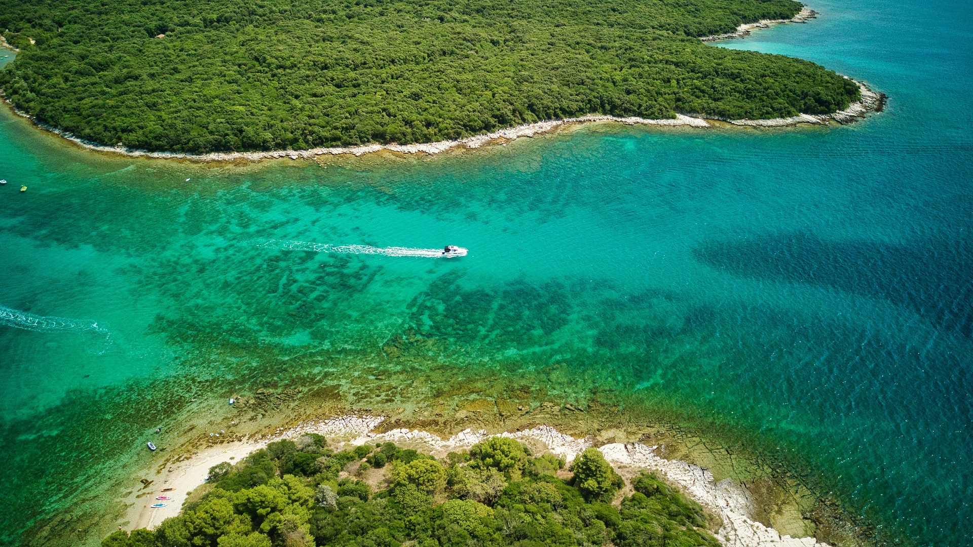
Further away from the town of Umag, especially along less frequented stretches of coastline, the sea becomes noticeably clearer and more open. Reduced maritime traffic and lower coastal density contribute to improved underwater visibility, particularly in stable weather conditions. In these areas, swimming often takes place directly from anchor, with vessels positioned in quiet bays or gently sheltered coastal zones.
The underwater environment typically consists of a natural mix of rock formations, sandy patches, and areas of seagrass. This combination is common throughout Istria and supports a balanced marine ecosystem while also influencing the character of swimming and anchoring areas. The presence of seagrass beds, in particular, often indicates calmer, shallower zones that are suitable for short swimming stops.
Rather than being organized around designated beaches or resort facilities, swimming in this region is closely linked to the sailing experience itself. Stops are determined by route planning, weather conditions, and the natural availability of sheltered water rather than fixed infrastructure. As a result, swimming becomes a fluid part of coastal movement—something that happens naturally between passages rather than within defined zones.
This integration of sailing and swimming is one of the defining aspects of the northern Istrian coast. Around Umag, the sea is not separated from the journey; it is part of it. Whether in a quiet morning bay or a calm anchorage further along the coastline, swimming is experienced as a direct extension of time spent on the water, shaped entirely by the surrounding maritime environment of Istria.
CONNECTION TO WIDER NORTHERN ADRIATIC ROUTES
Umag occupies a naturally strategic position within the sailing network of the northern Adriatic, where the coastline of Istria narrows and transitions toward international waters. Its location close to the Slovenian border gives it a dual function in cruising itineraries: it can serve equally well as an entry point into Croatia or as a final departure stop before leaving Croatian waters.
To the north, sailing routes from Umag extend seamlessly into Slovenian coastal waters and further toward the broader area of the Gulf of Trieste. This short northern passage is particularly relevant for international itineraries, where vessels move between different national maritime zones within a relatively compact sailing area. Despite the change in jurisdiction, the physical sailing environment remains consistent, with similar coastal conditions and wind patterns continuing across the border.
To the south, Umag connects directly into the broader western coastline of Istria, forming part of a continuous sailing corridor that includes towns such as Novigrad, Poreč, and further down toward Rovinj. These routes follow a generally sheltered coastline, allowing for comfortable coastal navigation with frequent opportunities for stops, anchoring, and short daily passages.
This north–south continuity is one of the defining characteristics of sailing in this region. Unlike more fragmented island systems in the central or southern Adriatic, the Istrian coastline allows for linear, flexible movement where destinations are connected by relatively short and predictable distances. Within this structure, Umag acts as a key hinge point at the northern end of the route network.
Because of its position, Umag is particularly valuable for international sailing itineraries. It can function as an entry point for yachts arriving from Slovenia or northern Adriatic waters, or as a final Croatian stop before exiting the country. This makes it highly adaptable for route planning, especially for crews managing time-limited charters or cross-border passages.
One of its most practical advantages is that it does not require extended offshore navigation to integrate into wider itineraries. The surrounding waters of Istria remain relatively close to land throughout, meaning that even longer coastal journeys can be broken into short, manageable segments without losing continuity. This allows sailors to maintain flexibility, adjusting routes based on weather conditions, crew preference, or timing constraints.
In this way, Umag functions less as an isolated destination and more as a navigational node within the northern Adriatic system. It supports movement in multiple directions while maintaining the simplicity and predictability that define sailing in this part of Croatia.
Ultimately, its value within wider routes lies in its positioning rather than its scale. By bridging Croatian and Slovenian waters and linking directly into the structured coastline of Istria, Umag enables fluid itinerary design across one of the most accessible and logically connected sailing regions in the Adriatic.
NORTHERN ADRIATIC SAILING ROUTE: UMAG
Umag stands out within the sailing landscape of Istria not because of dramatic scenery or iconic harbour silhouettes, but because of what it enables. It is a town defined by function, positioning, and continuity - qualities that often matter more than visual impact when planning efficient and flexible Adriatic itineraries.
Its strength lies in its role as a reliable maritime endpoint at the very edge of Croatia. Situated close to Slovenian waters, Umag occupies a transitional space where sailing routes naturally extend beyond national boundaries or flow back into the structured coastline of northern Istria. This makes it a natural point of arrival or departure, depending on the direction of travel.
For sailors, the practical advantages are immediately clear. Harbour access is straightforward, with a coastline that allows for easy visual approach and uncomplicated entry. The surrounding waters are typically stable during the main season, and wind patterns follow predictable daily cycles that support relaxed coastal navigation. These conditions reduce operational complexity and allow crews to focus on the rhythm of sailing rather than constant adjustment.
Equally important is Umag’s connectivity. From this position, itineraries can move southward along the Istrian coast toward destinations such as Novigrad, Poreč, and Rovinj, or extend northward into Slovenian maritime waters and the wider Gulf of Trieste. This dual-direction access gives the town a structural importance within northern Adriatic route planning that extends beyond its size or visual profile.
Unlike destinations built around concentrated historic cores or heavily touristic waterfronts, Umag offers a more distributed and functional coastal environment. It is designed for movement rather than spectacle, where marina infrastructure, services, and urban areas operate in close proximity to the sea without overwhelming it. This creates a seamless operational setting for yacht crews managing arrivals, departures, and provisioning.
In a broader sense, Umag represents a different expression of Adriatic sailing culture. While other locations in Istria emphasize history, architecture, or scenic intensity, Umag emphasizes usability and continuity. It is a place where sailing routes are not interrupted but extended, where transitions are smooth, and where coastal navigation remains straightforward and predictable.
Within the wider northern Adriatic, which includes contrast between historic towns, protected natural areas, and open coastal stretches, Umag occupies a grounded and stabilizing role. It may not be the most visually striking destination, but it is one of the most functionally important - supporting the structure of itineraries that connect multiple regions into a coherent sailing experience.
Ultimately, Umag belongs on a northern Adriatic sailing route because it ensures balance. It anchors the edge of the system, provides clarity in navigation, and enables seamless movement between Croatia and Slovenia. In a region shaped by variety and contrast, it is the quiet constant that keeps itineraries practical, flexible, and naturally connected.